Regarding the proposed ski resort development, I have taken steps in collecting and analyzing data from several sources concerning elevation within the development zone alongside noted ungulate (animal) and river habitats and areas of old growth forests where development would not be possible.
![]()
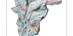
The primary goal of analysis was to create a visual representation of the whole development area overlaid with protected zones and a distinction between areas with elevation less and greater than 555m, which has been identified as the threshold of adequate snow levels. In doing this, we can determine which areas are appropriate for building ski runs. The reasoning behind declaring animal and river habitats and old growth forests to be protected areas is because they are important ecosystems that should not be disturbed by human activity. In addition to marking off the rivers themselves, I created a buffer extending 50 – 100m out in order to further protect the aquatic ecosystems. The buffer extends out 50m above 555m of altitude where temperatures are lower and less fish activity is anticipated, and it extends out 100m below 555m elevation where there is more activity in the rivers.
Results from analysis show that there is a large swath of land that lies below the snowline meaning that in these zones, there will be less snowfall than desired. The region below the snowline covers 16.4 square kms, which is roughly 30% of the total 54.7 square kms of project area. That translates to 30% of the projected area that would be unsuitable for building long term ski runs due to unreliable weather conditions. In addition to that, the total area of protected zones sums up to 20.1 square kms, which is a further 36.7% of land that is unavailable to be developed. It is important to note that there is protected habitat that lies below the 555m elevation mark, and further analysis is required to determine a “true” development area.
With this information in mind, the greatest obstacles to building this ski resort would be navigating around river habitats and utilizing the land below 555m elevation to its full potential. Possible solutions for the former issue would be to base ski runs off of existing roads, and potentially construct bridges to cross over water. Regarding the latter issue, it would be advisable to base a “village” type central area in the low elevation areas and add smaller scale attractions such as tubing or rail parks that open conditionally reflecting weather and snow levels or through the use of snow blowers. These are not concrete commands and there is still room for other proposals for land use.
![]()
In conclusion, key considerations when developing this ski resort are to find effective uses of the land that is below the snowline as well as working around protected zones, with extra care being focused on waterways. Planning lifts will be expected to be easier as towers need not cover a large area and only need to be mindful of old growth forests. The potential for a successful ski resort exists, but must be approached with careful and deliberate plans.
Applied knowledge of GIS and analytical skills in practical geographic applications.